GPS Course Maps: Yardages at Your Fingertips
You know that moment when you're standing in the fairway, squinting at the pin, and wondering if you've got 145 or 165? Those days are over.
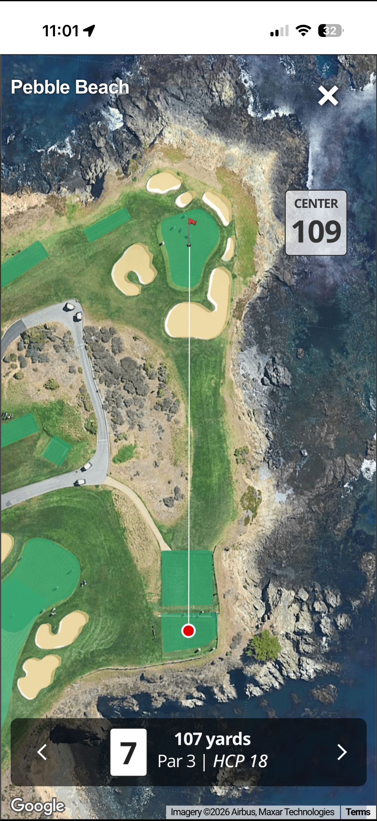
We've added full GPS course maps to Clubhousen. Satellite imagery meets rangefinder-level data, right on your phone. No extra device to clip to your bag. No subscription to a separate app. It's built into every round and every course page.
What You Get
When you open a course or start a round, you'll see a satellite view of the hole with live GPS distances. Distance to the pin. Distance to that creek you're trying to carry. Distance to the layup point that sets up your approach. Everything you'd expect from a rangefinder, but integrated into the app you're already using for scoring and your group.
Course features and details load alongside the map, so you're not just looking at a picture — you're getting the full context. Hazards, landing areas, and green contours are all there. The course page loads GPS maps reliably now, so you can trust it when you're on the first tee or planning your next round.
Growing the Course Library
We built internal tooling to import hole-by-hole GPS data for courses quickly and accurately. That means we can add and update courses faster, with yardages you can count on.
We've already loaded several standout tracks. TPC Scottsdale Stadium — home of the Waste Management Phoenix Open — is in. So are Troon North Pinnacle, Lookout Mountain, The Ranch, and Blackledge. More courses are being added regularly as we expand the database.
Whether you're playing a bucket-list course or your home track, rangefinder-level data is now at your fingertips. Pull up the map, check your number, and hit your shot.